")
Welcome to LandSurv
At LandSurv, we focus on practical and reliable geospatial solutions that bring real value to the field:
-
Integrated expertise – connecting surveillance, GIS, digital twin modeling, and risk assessment.
-
Clear decision-making – providing data and analysis that support informed actions on the ground.
-
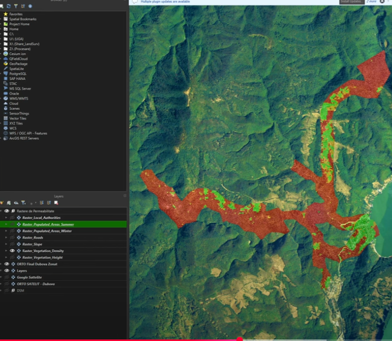
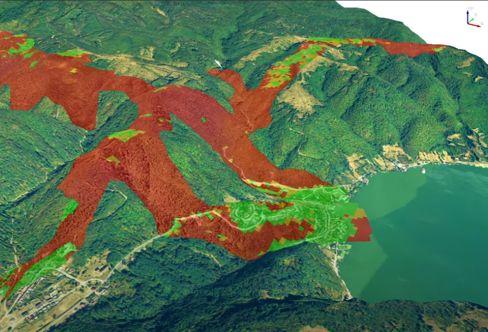
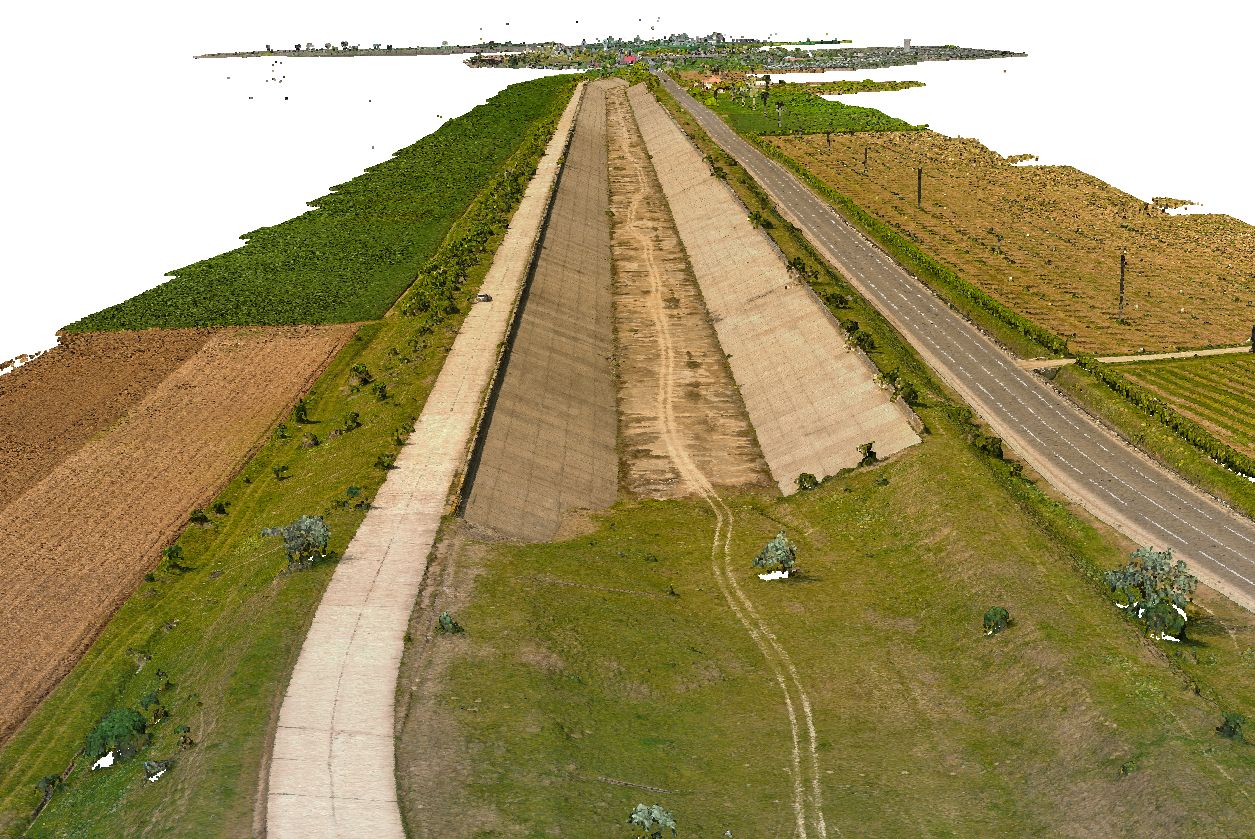
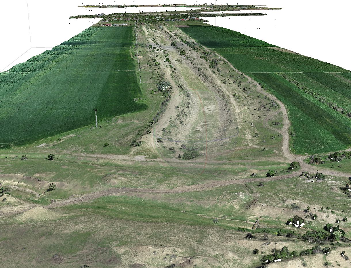
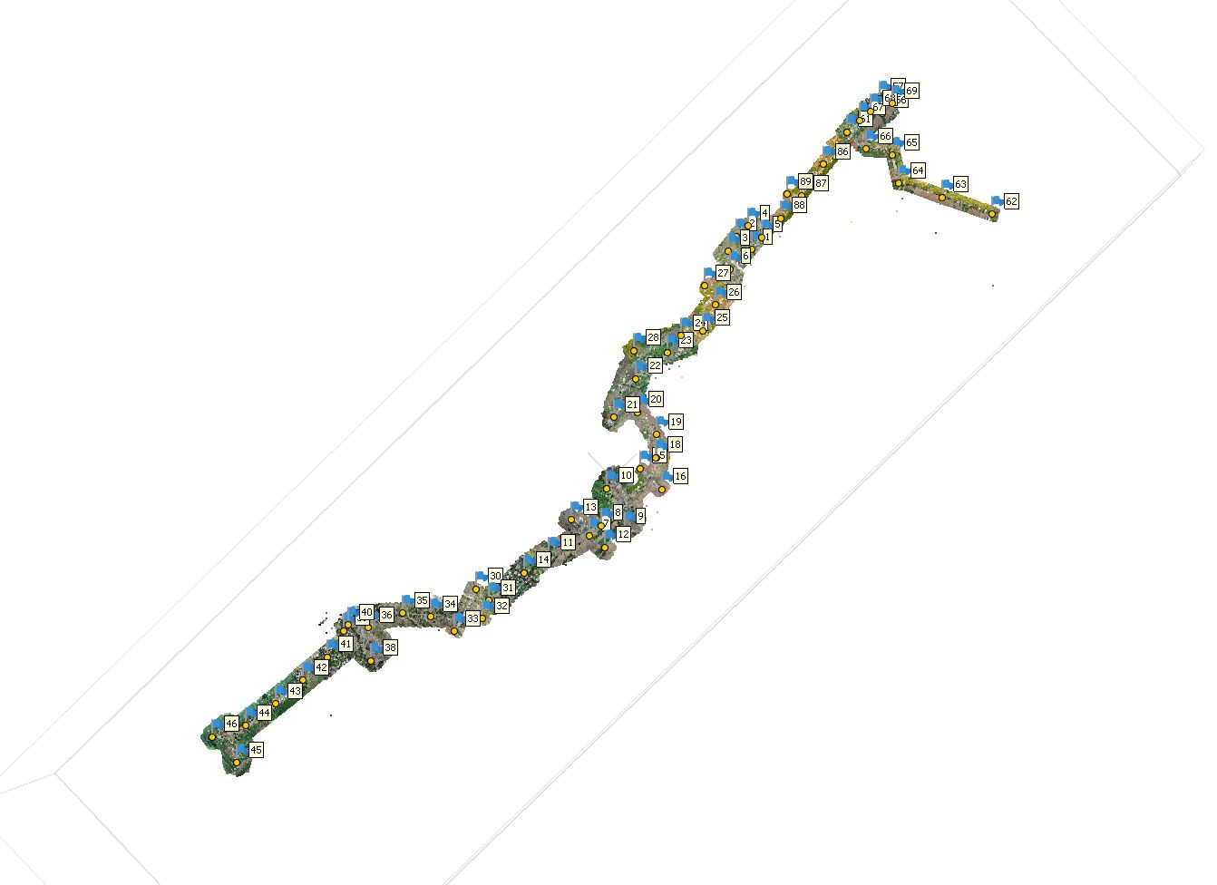
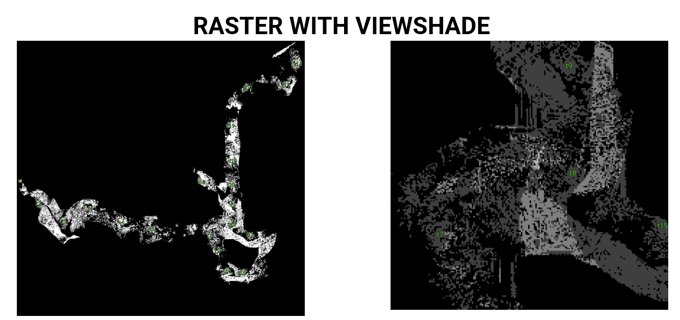
Drone-based mapping – analyzing terrain permeability and evaluating cross-border risks.
-
Dedicated team – small but focused, guided by the idea that technology should serve clarity, security, and smarter planning.
the reason
why should choose us?
We believe that technology should remain simple, clear, and useful. At LandSurv, we bring together surveillance, GIS, digital twin modeling, and risk assessment to create solutions that are practical and reliable:
-
Focused approach – each project is handled with attention to detail, adapting tools to the mission.
-
Trusted results – from mapping to permeability analysis and border risk studies, we deliver data you can rely on.
-
Step-by-step workflow – ensuring clarity and precision at every stage.
-
Our values – responsibility and transparency above big promises.

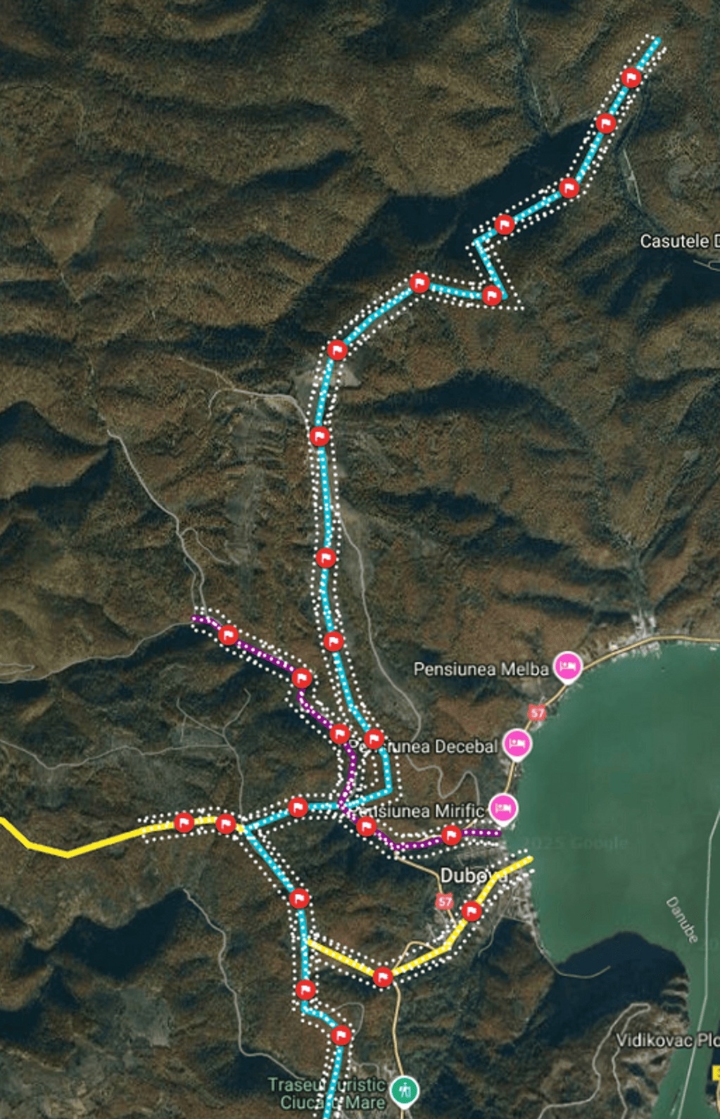
Quick Permeability Overview
")
Our Results


Showcase


")
")
")
")
")
")
")
Comunicări
Proiect PNRR: Digitalizarea KONDORCAD LANDSURV SR
KONDORCAD LANDSURV SRL este o societate de inginerie geodezică din România, fondată în 2017. Activitatea companiei include servicii de măsurători topografice și cadastrale, fotogrammetrie aeriană cu drone, cartografie digitală și sisteme GIS. Prin integrarea tehnologiei moderne și a experienței profesionale, compania furnizează date precise și soluții adaptate pentru proiecte de infrastructură și dezvoltare teritorială. Obiectivul principal este transformarea informațiilor din teren în modele digitale inteligente, esențiale pentru dezvoltarea durabilă și pentru luarea de decizii fundamentate.
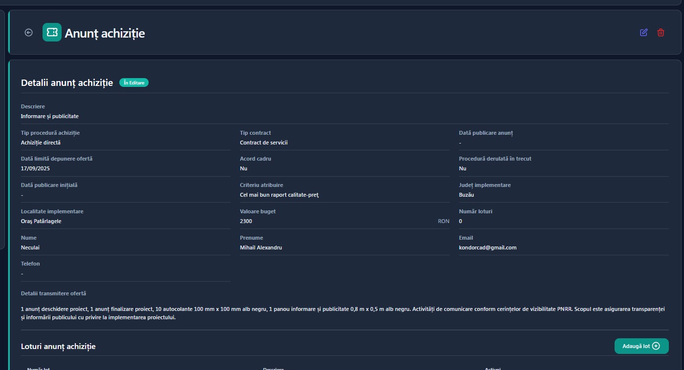
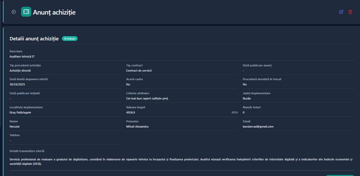
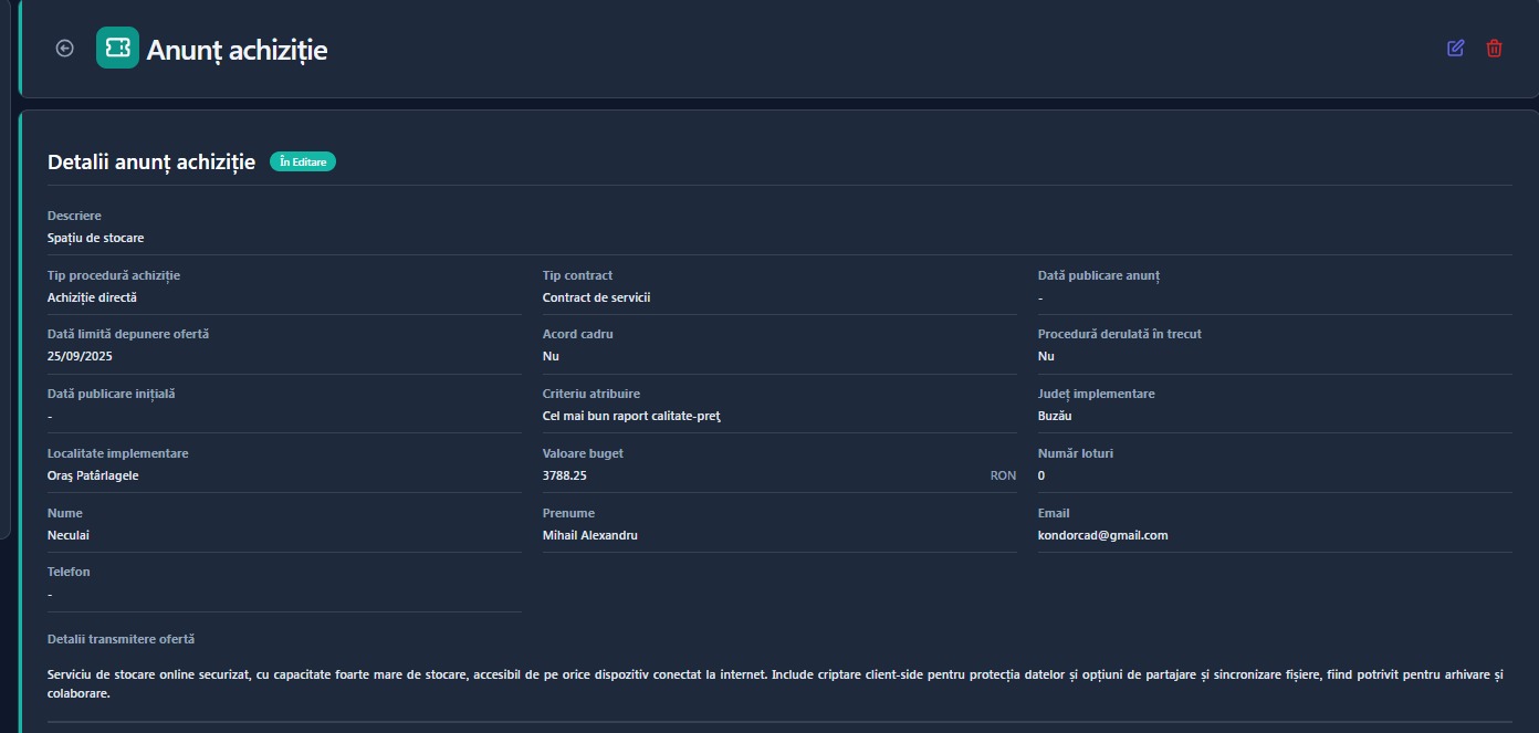
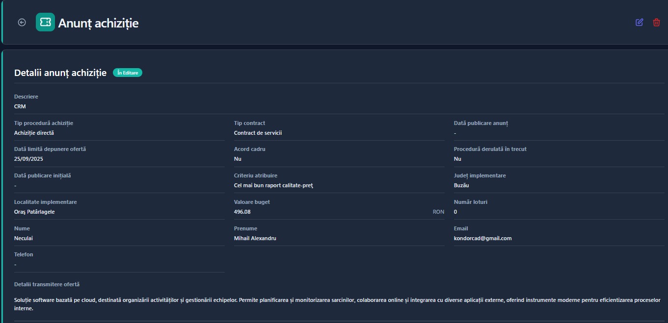
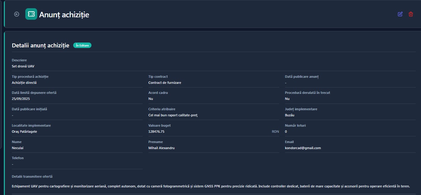
KONDORCAD LANDSURV SRL la data de 10 septembrie 2025 demareaza achizitiile aferente proiectului „Digitalizarea Companiei KONDORCAD LANDSURV SRL”, finanțat prin PNRR – Componenta C9, Investiția I3 (Nr. ordine 3393.1/i3/c9).
Finanțare:
• Program/finanțator: Planul Național de Redresare și Reziliență (PNRR), prin MIPE
• Valoare eligibilă: 171.085,24 lei
• Asistență financiară nerambursabilă: 145.422,45 lei
• Contribuție proprie (eligibil): 25.662,79 lei
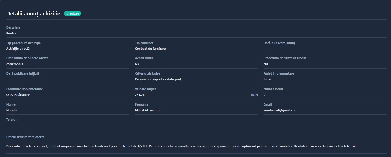
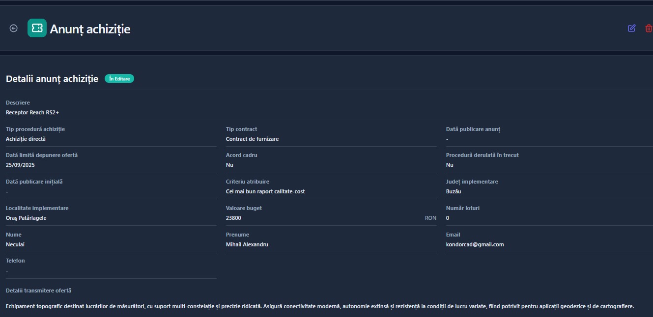
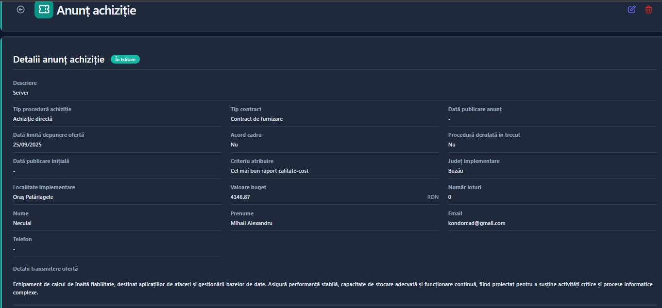
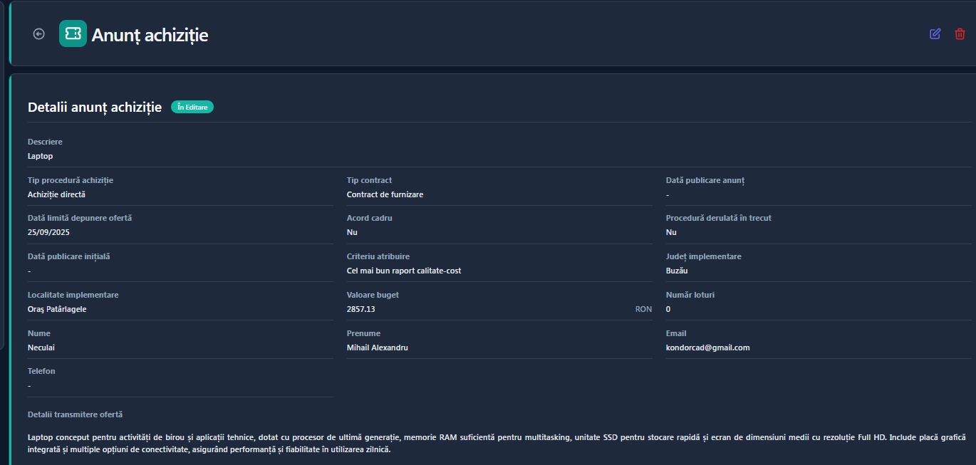
Echipamente și activități vizate pentru achiziție:
• Set dronă UAV
• Laptop
• Server
• Receptor GNSS Reach RS2+
• Router
• Sistem CRM
• Spațiu de stocare
Prin acest proiect, compania urmărește modernizarea și digitalizarea activităților prin achiziția de echipamente performante și soluții software integrate, ceea ce va contribui la creșterea eficienței operaționale, la îmbunătățirea calității serviciilor și la consolidarea competitivității pe piață.